115-850
Peabody City Park
600 W DIVISION
Peabody

LOCATION:
County:Marion
Address: 600 W DIVISION
Address Remarks:Entrance at W 2ND ST and LOCUST ST
City:Peabody
Zip:66866
Parcel ID:252-04-0-30-05-001.00-0
Legal Description: Section 4 Township 22S Range 3E
Legal Description Remarks:23.16 acres, PRT SW/4 BEG NW/C E 1089' TO W LI LOCUST ST S 948.75' W 1089' N 948.75' TO POB LESS ROW 96/623
Latitude, Longitude 1:38.166321 -97.114871
Latitude, Longitude 2:
Latitude, Longitude 3:
Latitude, Longitude 4:
Datum:WGS84
DESCRIPTION:
Historic Name:Peabody City Park
Alternate Name:Marion County Agricultural Society Fairgrounds
Historic Function:Recreation and Culture
Subcategory:Fair
Historic Function Remarks:The first portions of this park, the octagonal pavilion and the horse racing track, were built around 1885 for the State Fair held that year in Peabody. Later changes to the Park occurred in 1937 when, with WPA funding, the area was redesigned for a city park. A baseball field and a football field were constructed on the east portion of the park, complete with stone bleachers behind home plate and parallel to the football field. Stone entry piers were constructed at the same time, as were picnic table groupings with stone chimneys and a playground. An Osage Orange hedge border was planted around the parks northern and western perimeters. Elms were used along the southern border. Other tree groupings included pines, cedars, cottonwoods, and sycamores.
The 1902 Standard atlas of Marion County called this area the Fairgrounds. In the 1922 and 1930 Sanborn Maps, this area is referred to as the City Park and Tourist Camp Grounds.
Present Function:Landscape
Subcategory:Park
Present Function Remarks:Continues its function as a public playgrounds for all ages of the community. Fourth of July events are celebrated here every year. A picnic shelter was constructed at the NE portion of the park in 2000. The playground equipment currently in place is located in the same vicinity as was proposed in the 1937 site plan.
Residential/Commercial/Religious Style:Other
Secondary Style:
Barn Type:Not Applicable
Bridge Type:Not Applicable
Landscape Type:Public Park
Physical Description/Remarks:
Plan Form:Rectangle
Commercial Building Type:Not Applicable
Roof Form:Not Applicable
Stories:
Condition:Good
Principal Material:
Condition Remarks:
Architect/Designer/Builder:Unknown
Year of Construction:1885
Certainty:Documented
Date Notes:1937 changes
General Remarks:For more information and photographs,click the following:
Peabody City Park Athletic Field.
Peabody City Park Octagonal Pavilion.
Peabody City Park Horse Racetrack.
Ancillary Structures: None
Ancillary Structure Remarks:
OWNER:
Name:City of Peabody
Address: 300 N WALNUT ST Peabody KS 66866
Address Remarks:
REGISTER STATUS:
Listed in State Register:Yes
Date of State Listing:11/19/2011
Listed in National Register:Yes
Date of National Listing:01/20/2012
Historic District:
Demolished:
Date Demolished (if applicable):
Potentially Eligible for National Register:
Register Status Remarks:Listed under the New Deal-Era Resources of KansasMPS.
Thematic Nomination (MPDF):New Deal-era Resources of Kansas
National Historic Landmark:   
SURVEY INFORMATION:
There is no survey information for this record.
RECORD REVIEW:
Reviewed By:Amanda Loughlin
Review Status:Approved
IMAGES & DOCUMENTS:
Click image or icon for a larger view or to open document. (opens new window)

Peabody City Park. South pier of entry. 02/23/2011. KSHS/Martin, Sarah.

Peabody City Park. Stone entryway. 02/23/2011. KSHS/Martin, Sarah.

Peabody City Park. North pier of entry. 02/23/2011. KSHS/Martin, Sarah.

Peabody City Park. Picnic tables at east side of park. 02/23/2011. KSHS/Martin, Sarah.

Peabody City Park. Looking south from race track drive towards pavilion and ballfields. 02/23/2011. KSHS/Martin, Sarah.

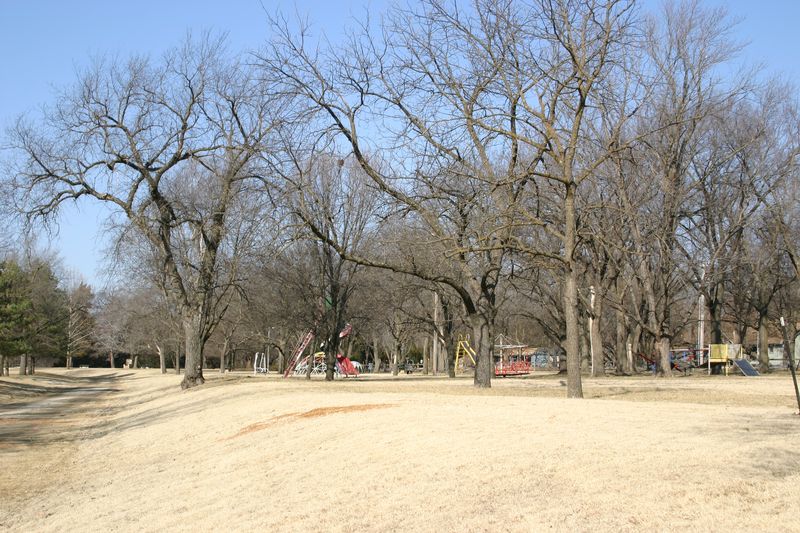
Peabody City Park. Playground on north side of the park. 02/23/2011. KSHS/Martin, Sarah.

Peabody City Park. Site Plan. Base photo courtesy ACME Mapper (accessed 02/22/2011).

Peabody City Park. Baseball bleachers along north side of baseball field, facing E. 02/23/2011. KSHS/Martin, Sarah.

Peabody City Park. Floral Exhibition Hall, facing NW. 02/23/2011. KSHS/Martin, Sarah.

Peabody City Park. Floral Exhibition Hall, facing NE. 02/23/2011. KSHS/Martin, Sarah.
Peabody City Park. Sanborn Map. 1922.
Peabody City Park. Sanborn Map. 1930.
Peabody City Park. National Register Nomination. 09/2011. Jones Marilyn & KSHS/Martin, Sarah and Loughlin, Amanda.